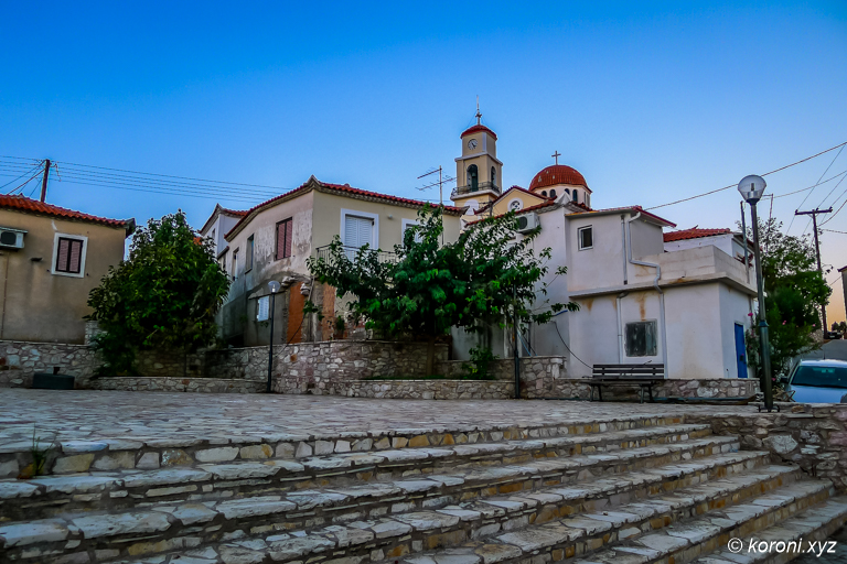
Vasilitsi – The southest Village of Messinia
get Vasilitsi City Map (Free)
get Koroni Surroundings Map

- Vasilitsi is the Southest Village of Messinia
- the hamlets Livadakia & Faneromeni belong to Vasilitsi
- various beaches
- Cape Akritas, Venetico Island & Egg Islands belong to Vasilitsi
- it takes about 7 km from Koroni to Vasilitsi, lying on the right from the Road Koroni – Methoni
- it is about 3 km from where this road leaves the coast
- the church of Agios Vasilios is about 145m above sea



About Vasilitsi
Some Facs About Vasilitsi
- Vasilitsi is the Southest Village of Messinia
- It is in the southern outback of Koroni
- it takes about 7 km from Koroni to Vasilitsi, lying on the right from the Road Koroni – Methoni
- it is about 3 km from where this road leaves the coast
- the church of Agios Vasilios is about 145m above sea
- until 1997, it was an own community
- in the Kapodistrias Reform 1997, Vasilitsi was integrated into Dimos Koronis
Koroni Dimos (Kapodistrias) Map - in the Kallikratis Reform 2010, Dimos Koroni got integrated into Dimos Pylos-Nestoros
Dimos Pylos-Nestoros (Kallikratis) Map
- Livadakia
- Faneromeni
- Selitsa & Cape Akritas Area
Cape Akritas & Selitsa – photos & info - Various Beaches: Agios Nikolaos, Ammoudi, Kalamaki, Selitsa
- Venetiko Island
- Egg Island
- Vasilitsi City Map (Free)
- Koroni Surroundings Map
- Akritas Map
- Overview Maps (Koroni Map Series) (Messinia, Peloponnese, Greece)
- Koroni Dimos (Kapodistrias) Map
- Dimos Pylos-Nestoros (Kallikratis) Map
- The digital map is designed for offline usage and various functions like showing your GPS Position, GPS tracking, adding Points of Interests & geotagged Photos.
Vasilitsi on the Map
last revised: 31. March 2026
published: 8. April 2018